
“Look at a map of Australia’s east coast and trace the edge of the sea — that line of blue beyond the coastline, that is where the Great Barrier Reef begins.”
On the Edge of a Continent: The Geography of the Great Barrier Reef
The Great Barrier Reef lies in the Coral Sea, off the north-east coast of Australia, in the state of Queensland. It extends from the Torres Strait — the channel between Australia and Papua New Guinea in the far north — to just south of the Tropic of Capricorn, near the town of Bundaberg. This north-south stretch spans more than 2,300 kilometres of the Australian coastline, making the reef the largest living structure on Earth and the largest coral reef system in the world.


Latitude and Longitude
The Great Barrier Reef sits between approximately 10 degrees South (near the northern tip of Queensland) and 24 degrees South (near Bundaberg). In longitude, it occupies the sea between roughly 145 and 154 degrees East. The reef lies on the Australian continental shelf — the shallow underwater platform that extends outward from the continent before dropping away to the deep ocean floor. The water depth over the reef ranges from just a few metres on the inner reef flat to several hundred metres on the outer continental slope.
The Gateway Cities
The primary gateway towns and cities for visiting the Great Barrier Reef are Cairns (in the north, servicing the northern and central reef), Port Douglas (north of Cairns, with exclusive access to Agincourt Reef), Airlie Beach and the Whitsunday Islands (in the central region), Townsville (servicing the central reef and the SS Yongala wreck), and Bundaberg and Gladstone (for access to the southern Great Barrier Reef, including Heron Island and Lady Elliot Island). Each gateway provides access to a different section of the reef with its own character and features.
The Inner and Outer Reef
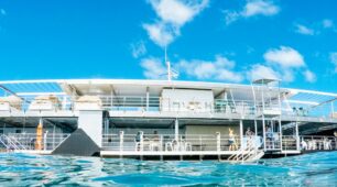
The reef is broadly divided into inner and outer sections. The inner reef lies close to shore, often within 15 to 30 kilometres, and consists of fringing reefs, coral cays, and island reefs in relatively shallow water. Outer reef sites sit further from the coast — 30 to 90 kilometres offshore — at the edge of the continental shelf where the water is deeper, visibility is greater, and coral diversity tends to be highest. Most day tours from Cairns and Port Douglas travel to the outer reef in high-speed catamarans.
Regions of the Great Barrier Reef
The reef is often divided into three broad regions. The Far Northern Reef, above Cairns, is remote and largely accessible only by liveaboard. The Central Reef encompasses the waters around Cairns, Port Douglas, the Whitsundays, and Townsville — this is the most visited section, with the greatest range of tour options. The Southern Great Barrier Reef, from the Whitsundays to Bundaberg, is less heavily touristed and contains some of the reef’s most distinctive island and coral cay environments.


Getting There
The most practical way to reach the Great Barrier Reef from overseas is to fly into Cairns (which has limited international connections from Asia and the Pacific), or to connect domestically through Brisbane, Sydney, or Melbourne. Cairns Airport is the primary hub, with daily domestic flights operated by Qantas, Virgin Australia, and Jetstar. Once in a gateway town, reef day tours depart from the waterfront and require no further travel. The most popular way to visit is a Reef Experience day tour from Cairns.
A Hot Getaways destination. Where Care is Our Compass.
FAQs
Where is the Great Barrier Reef located?
How long is the Great Barrier Reef?
Which cities are closest to the Great Barrier Reef?
How far is the reef from the mainland?
Can you see the Great Barrier Reef from space?